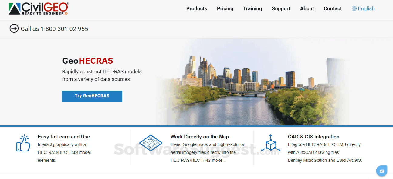
What is GeoHECRAS?
GeoHECRAS is a fully featured CAD Software designed to serve Agencies, SMEs. GeoHECRAS provides end-to-end solutions designed for Windows. This online CAD system offers at one place.
GeoHECRAS Starting Price
Our Awards and Recognition
Talk with a software expert for free. Get a list of software that's great for you in less than 10 minutes.
Key Features of GeoHECRAS
Here are the powerful features that make GeoHECRAS stand out from the competition. Packed with innovative tools and advanced functionalities, this software offers a range of benefits.
- 4-Axis Milling
- Database Connectivity
- View .DWF Files
- View .DWG Files
- View .IGES Files
- View .STEP Files
- 2 1/2-Axis Milling
- 2D Drawing
- 3-Axis Milling
- 3D Modeling
- 3D Viewers
- 4-Axis Milling
- 5-Axis Milling
- Animation
- Annotations
- Architectural Symbol Library
- 2D Drawing
- 3D Modeling
- 3D modeling and visualization
- BIM (Building Information Modeling) Integration
- Bridge Design and Analysis
- CAD (Computer-Aided Design) integration
- Civil Engineering
- Collaboration and Teamwork Tools
- Construction Design
- Construction Documentation and Reporting
- Construction Management
- Design Optimization
- Earthwork and Excavation Analysis
- Engineering
- Environmental Impact Assessment
- Geospatial Data Processing
- Android & mobile support
- Dashboards & Analytics
- 24/7 Monitoring
- 24/7 Support
- 24×7 Priority Support
- 3D Design
- 3D modeling and visualization
- 3D Spooling
- 3D View
- 3rd Party Integrations
- BIM (Building Information Modeling) compatibility
- Building automation and control
- Cable and wire routing
- Circuit design and distribution
- Code compliance checking
- Compatibility for Mobile and Tablet
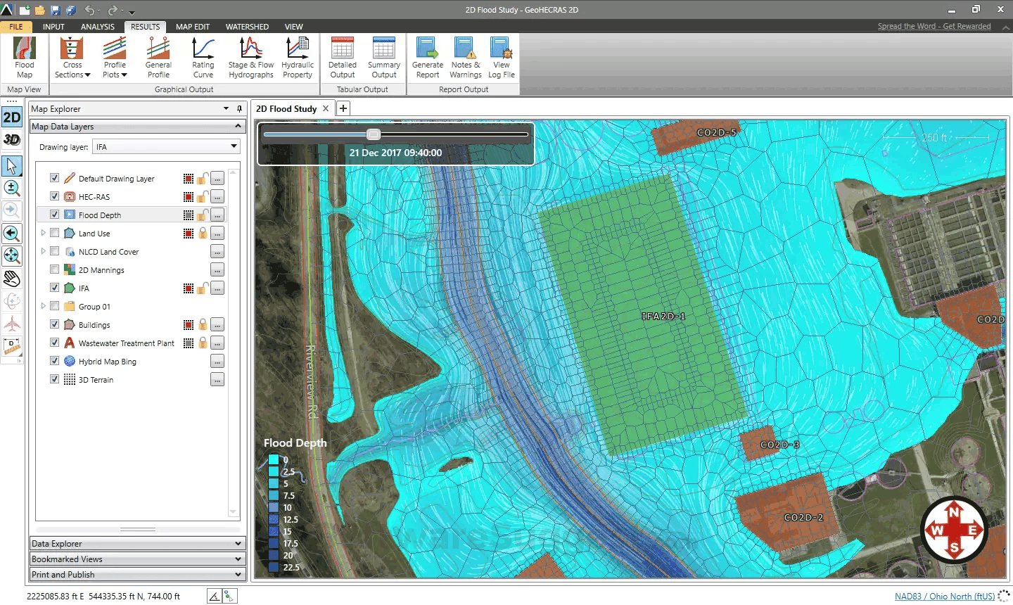
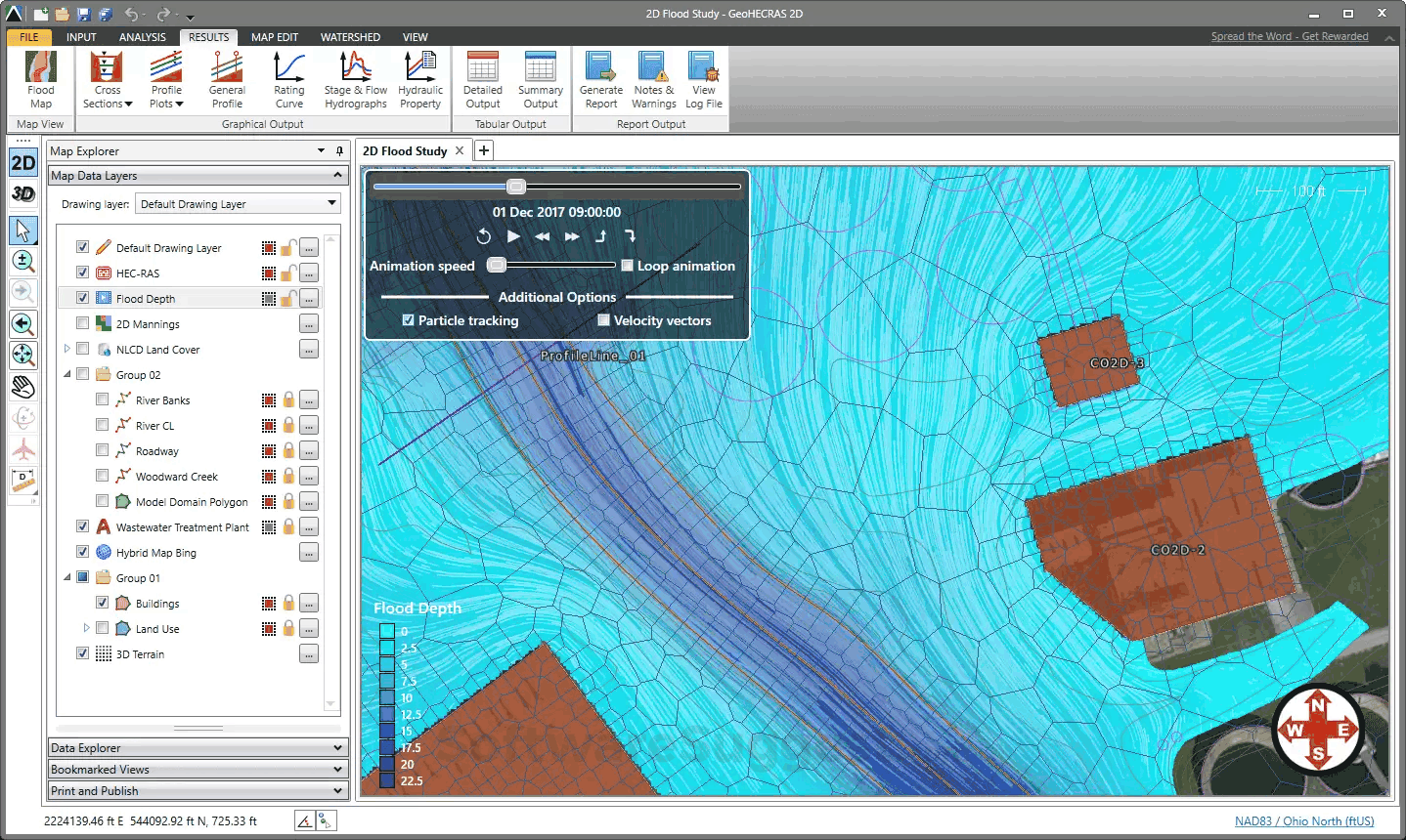
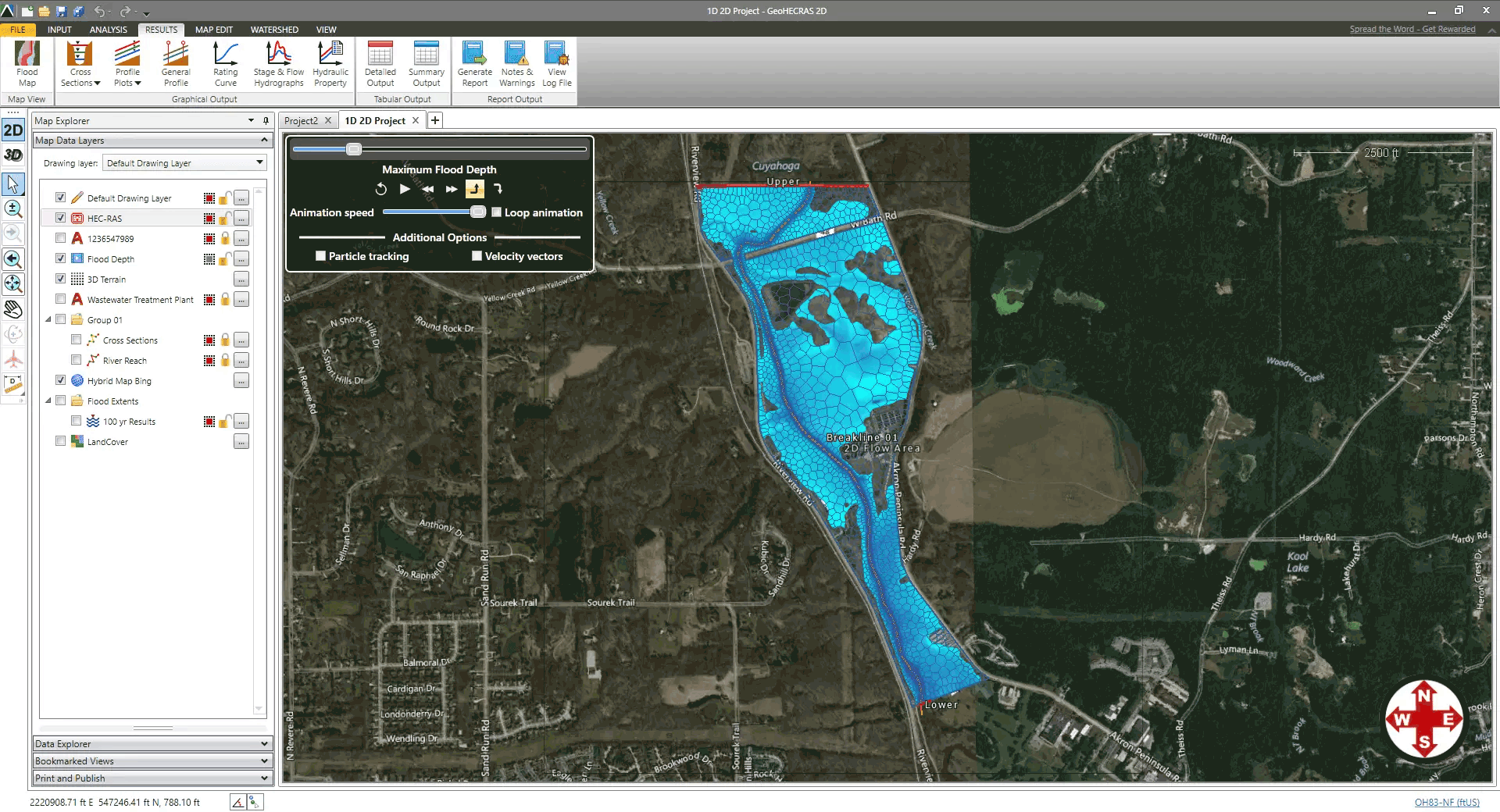
GeoHECRAS Screenshots
GeoHECRAS Specifications
Get a closer look at the technical specifications and system requirements for GeoHECRAS. Find out if it's compatible with your operating system and other software.
GeoHECRAS Videos
GeoHECRAS Reviews (0)
No reviews yet. Rate this app or be the first to review.
Write a ReviewAlternatives of GeoHECRAS
Explore alternative software options that can fulfill similar requirements as GeoHECRAS. Evaluate their features, pricing, and user feedback to find the perfect fit for your needs.
GeoHECRAS FAQs
What are the top 5 features for GeoHECRAS?
The top 5 features for GeoHECRAS are:
- Document Management
- Project Management
- Work order management
- Customer DataBase
- Collaboration Tools
What type of customer support is available from GeoHECRAS?
The available support which GeoHECRAS provides is:
- Phone
- Live support
- Tickets
- Training
Where is the headquarters/company of GeoHECRAS located?
The headquarters/company of GeoHECRAS is located at Middleton.